")
Introduction
For millennia, archaeological discovery was a slow, painstaking process involving years of digging and mapping. Today, the world of ancient history is being revolutionized not by the shovel, but by technology. High-resolution satellite imagery, airborne Light Detection and Ranging (LIDAR), and machine learning algorithms are penetrating dense jungle canopies and shifting desert sands to unearth the true scale of forgotten civilizations. This digital revolution is proving that many of the sites we thought we knew were actually only small parts of colossal, sprawling ancient metropolises.
LIDAR: Seeing Through the Jungle
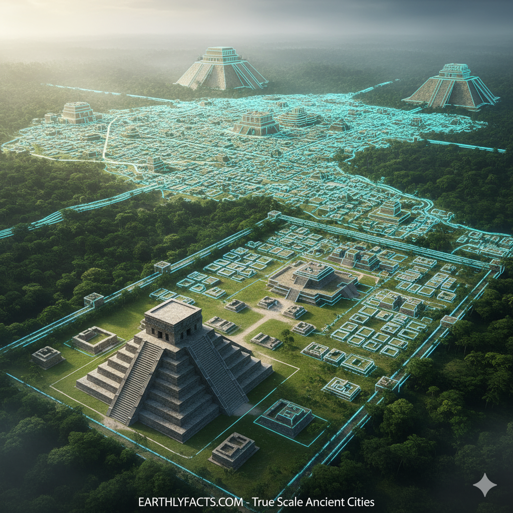
The biggest game-changer is LIDAR (Light Detection and Ranging). Mounted on airplanes or drones, LIDAR fires billions of laser pulses down to the ground. While forest canopy absorbs most of the light, enough pulses penetrate the gaps to map the bare earth beneath, effectively digitally stripping away the jungle.

The Mayan Megacity Revelation: In Central America, LIDAR has revealed a previously unknown Mayan “megalopolis” beneath the Guatemalan jungle. Instead of scattered city-states, the data shows an interconnected network of cities, fortifications, and sophisticated raised highways (causeways), dramatically increasing the estimated population of the Classic Maya.
Angkor’s True Size: LIDAR surveys around the famous Angkor Wat complex in Cambodia have revealed that the known temples were just the ceremonial core of a massive, urbanized area, complete with a complex hydraulic system necessary to support a population of nearly a million people.
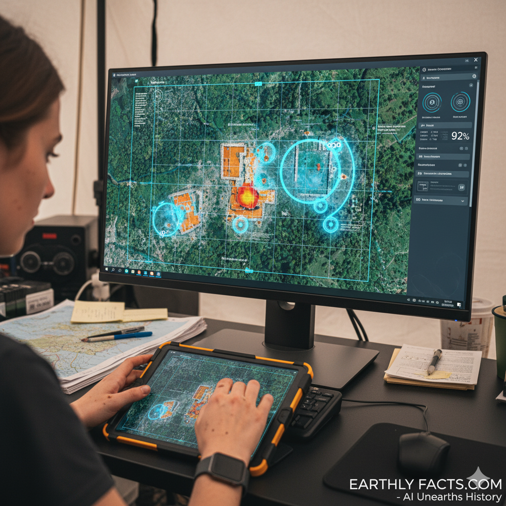
Satellite Imagery and AI Analysis
While LIDAR is best for forested areas, high-resolution satellite imagery, when paired with powerful Artificial Intelligence, is driving discoveries in dry and desert environments.
Subsurface Imaging: AI is trained to analyze subtle, often invisible, markers in soil color, moisture retention, and micro-relief—clues that indicate the presence of buried walls, roads, and irrigation channels.
Egypt’s Lost Cities: This technique has been instrumental in helping to map vast, non-visible portions of ancient Egyptian cities and tombs, offering archaeologists a “digital map” before they ever break ground. The ability to prioritize excavation sites based on probability has accelerated discovery tenfold.
The Implication for Earthly History
The new age of digital archaeology isn’t just about finding more ruins; it’s about revising history itself. The consistent thread from these digital surveys is that ancient human civilizations were far more complex, populous, and technologically advanced than we previously assumed. As global mapping continues through 2025 and beyond, we should expect a fundamental reassessment of nearly every major ancient civilization on Earth.

Conclusion
The era of romantic, solitary discovery is being replaced by the power of data. By leveraging aerial and orbital technology, the world of history is expanding at an unprecedented rate. The “earthly facts” of our ancient past are proving to be larger and more extraordinary than any previous generation of historians could have imagined.

")


")

